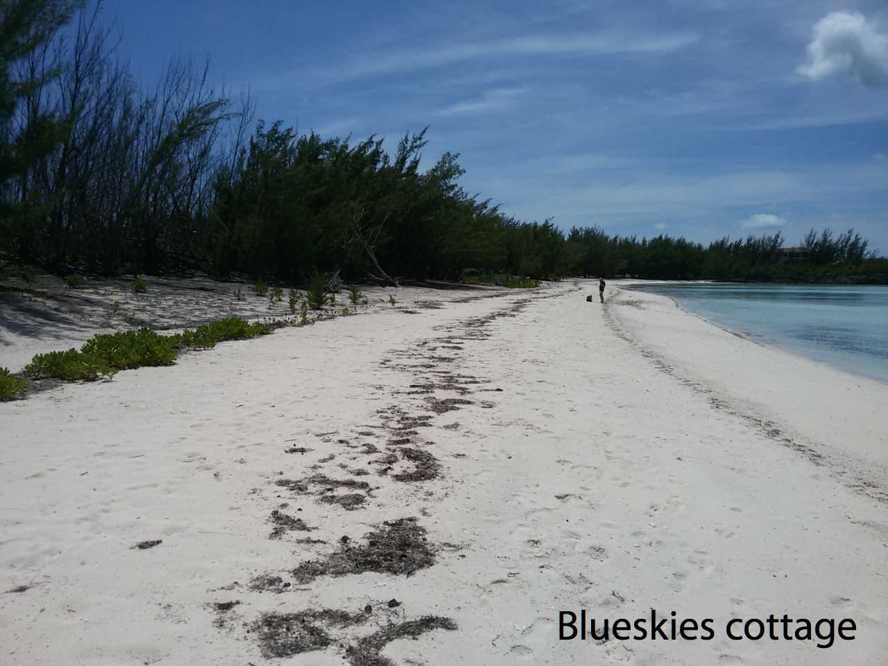
Winding Bay
The beach at Winding Bay is long and curving and well protected from the Atlantic waves. It is located 7 miles north of Rock Sound and is ideal for swimming and walking the length of the entire beach is about 1.6 miles.
Driving directions
Driving from the North: 9.9 miles south of the Savannah Sound lookk for a SHELL petrol pump. Please note that we don’t mean the one you will see as you drive into Tarpum Bay, but another one outside of Tarpum Bay on your way to Rock Sound.
At that SHELL station turn left into a paved road and continue for 1.4 miles to VENTA CLUB on your left (the Italian resort is now closed but was quite popular few years ago). Go for another 0.4 miles to an easily visible beach access path to your left. This trail is about 150 yards long. Park your car in the shade and walk the last few steps to Winding Bay beach.
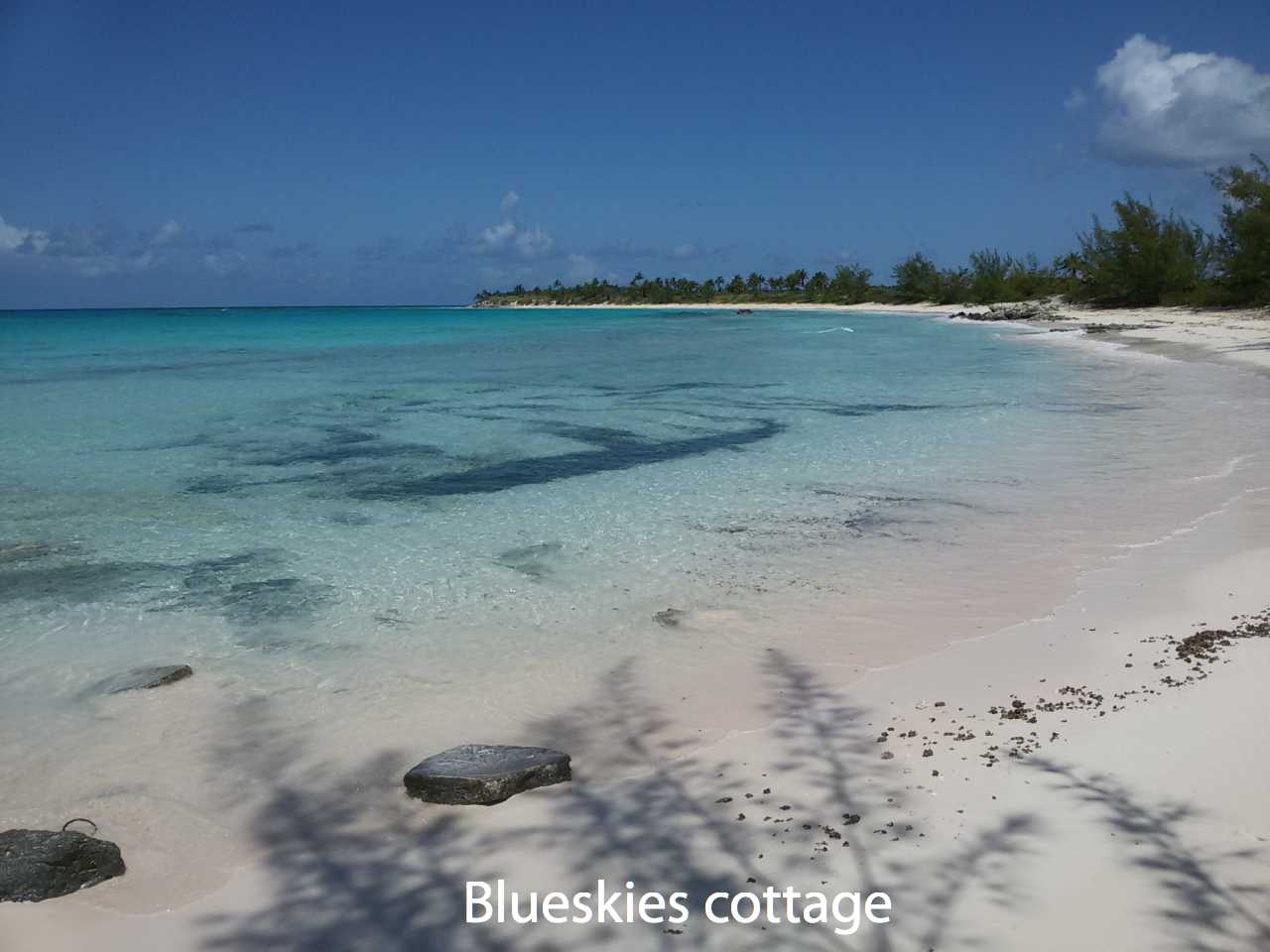
Whiteland Beach
This beach on the Atlantic side is about 4 miles south of Rock Sound. As you discover visiting Eleuthera the more difficult a beach is to find the more the place is worth the effort. And Whiteland beach, one of the best South Eleuthera beach, is no exception. The shore is lined with palm trees, is reef-protected and has a sandy bottom.
Driving directions
0.7 miles south of Rock Sound Hardware, Turn left onto Fish Road, and continue for 1.5 miles until you reach a T-junction at the end of the road; turn right, and follow this bumpy dirt road for 2.9 miles to the beach. The shore is lined with palm trees and the beach stretches for miles both ways. If you take a left, go to one of the few rivers that runs into the ocean, at one of the cliffs, about a mile down to the left.
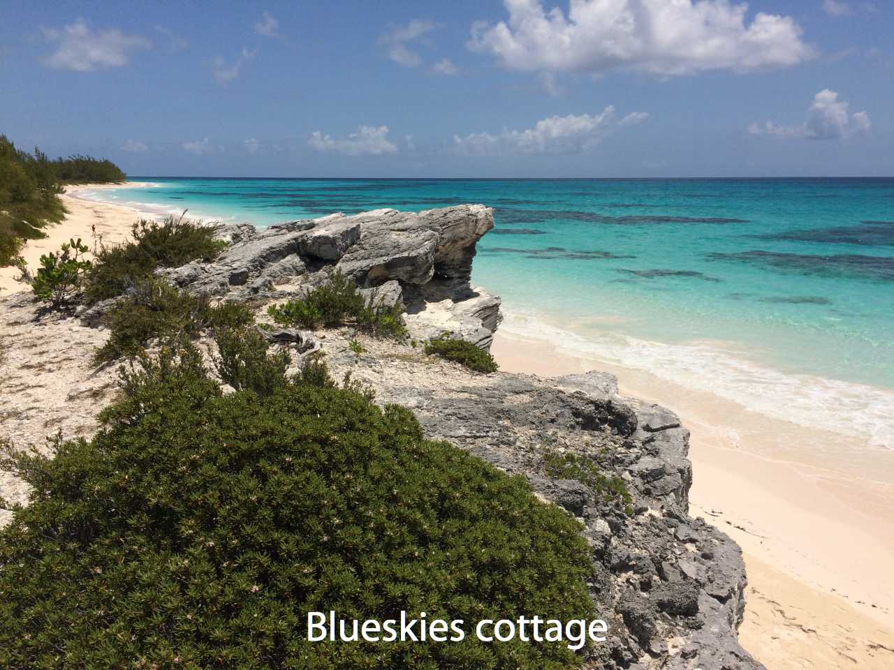
Lighthouse Beach
Lighthouse Beach is known as the best beach on Eleuthera. A 3 mile long, wide, pink sand beach that wraps itself around the southern tip of the island. To get the best from this trip please take into account that the beach is almost 50 miles south of Governor’s Harbour, e.g. a two hours drive. So take a full day to get there and have enough time to explore this beautiful place. Also it is recommended to use a jeep since the last three miles are on a rough road.
You can find some shade amongst the cliffs at the southern end of the beach. As this beach wraps right around the tip, you’ll pass by a part of it on the Caribbean side as you make your way to the main beach. You can also stop at the northerly part of the beach.
Driving directions
To reach Lighthouse beach take Queens Highway south. When you get to the settlement of Green Castle look for the intersection where there is a white picket fence that surrounds the white multi-directional sign post. Bear to the left towards Bannerman Town. You will then travel 9.6 miles to the cement block “Bannerman Town” sign. Go straight. It is 3.4 miles from this sign to the parking area.
The road narrows and turns to a sand/rock track. Drive slow as you pick your way through the bumps and pot holes. When you pass the stink pond on the left (if the wind is right, you’ll smell it before you see it) you’ll know you’re going the right way. Keep going until the sand track makes a sharp left and goes up a small steep hill. Park here, on the right, before the hill. The crescent shaped beach you see is Lighthouse Bay, the small beach. On the left, walk up the hill to the Atlantic side. This is Lighthouse Beach. The old lighthouse is on the hill between the two sides.


Leave A Comment